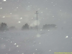
Blizzard Preparedness
How to prepare
Have a storm prepardness kit, safe place and heat in case of power outages.
Safeness
Listen to weather updates, stay indoors, dress wamly and avoid driving and walking.
Watching and Warnings
watch- Chance this condition will happen and usually covers a large geogaphic area for a lengthy period.
warning- weather is occuring and take proper protective measures, these are small geographic areas and short time period.
Tools to measure weather
Anemometer are used for measuring temp, air masses and wind speed,. weather ballons, thermoters, and baromters.
Satellites
Observe cloud patterns and use radar to measure precipatation.
Type of satellites
Infared -sensor reads temp. IR sensor board polar obriting and geostationary satellitee measure amount of infared energy emitted by Earth and atmosphere- amount of energy depends on temp. Info can be used to observe thermal.
Water vapor- Specfic wavelengh absorbed by atmosphere especially by cloud and suspend water vapor. Other wavelength, energy is not absorded and not transmitted. Imag shows large conceration of water vapor in middle and upper troposphere. It is very valuable tool for weather analyisis and prediction.
Visable- Indicates amount of solar radiation reflected from earth. Light tones represent areas of high reflectiviy and darker tones represent areas of low reflectivity. features on earth vary in reflectivity.
